Aerial Drone Surveying and Mapping
Drone Surveying / Mapping in India
Equinox’s Drones strives to provide clear-cut aerial drone surveying and mapping services across India. From serving the government and private sector in land surveying, aerial surveying for land management and development, land slope monitoring, stockpile volumetric measurements, designing smart cities, and mapping greenfield projects, our experience remains unsurpassed. Equinox’s Drones prioritizes quality and consistently achieves highly accurate topographic maps with centimeter-level accuracy. Equipped with state-of-the-art surveying drones and a team of expert licensed pilots, our clients can access deliverables with greater speed, facilitating more nimble decision-making processes.
Our drone surveying and mapping expertise ensures precise and reliable results for diverse projects, utilizing UAV drone survey techniques and making us a top choice for drone surveying, drone surveying and mapping, drone mapping and surveying, UAV surveying and mapping, drone survey mapping, UAV drone survey, and UAV in surveying. As one of the leading drone survey companies in India, we excel in providing advanced drones and surveying services, ensuring unparalleled UAV for surveying and mapping solutions.
Deliverables we provide:
- Orthomosaic maps
- 3D point cloud
- Digital surface models (DSM)
- Digital Elevation Model (DEM)
- Digital Terrain Model (DTM)
- CONTOUR MAPS
- 3D Textured Maps
We can help with

Land Surveying

Land Management & Development

Stockpile Volumetric Measurements

Slope Monitoring
Slope failure represents a significant geological risk, and early detection is crucial to ensure safety. Our team of experts employs GIS mapping techniques to effectively identify ground surface steepness, utilizing the Digital Terrain Model (DTM) and Digital Surface Model (DSM) as part of the slope monitoring process. This information, along with the LIDAR survey data, is essential for slope monitoring, landslide mitigation, and prevention of slope failure. Aerial survey mapping is an added valuable tool used by specialists to track the Earth’s movement to help predict and prevent such destruction.

Urban Planning
Deliverables We Provide
Orthomosaic Maps

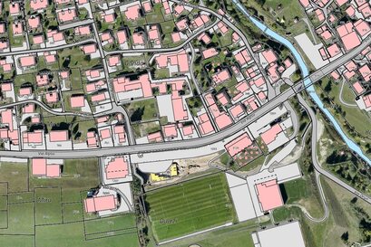
Drone images undergo correction for image distortion and are seamlessly merged during post-processing to generate a remarkably precise orthomosaic map. Every pixel within this map carries detailed 2D geographic data (X, Y), enabling precise measurements like horizontal distances and surface areas to be directly obtained.
3D Point Cloud

Drone images can be processed to produce a dense point cloud. Each point within this cloud encapsulates geospatial coordinates (X, Y, Z) and color details, furnishing a highly accurate model for measuring distances (both slant and horizontal), as well as determining areas and volumes.
Digital Surface Models (DSM)

Digital Terrain Model (DTM)

Following the removal of objects like buildings, the drone images can be utilized to construct Digital Terrain Models (DTMs). In these models, each pixel stores 2.5D information, including the X, Y, and Z values corresponding to the highest altitude.
Contour Maps

3D Textured Mesh

The 3D textured mesh serves as a replica of the region captured by the drone, encompassing its edges, faces, vertices, and texture. This model proves particularly valuable for visual inspections or when project collaboration involves external stakeholders or public engagement.
Our Features
10x Faster Data Acquisition
Our team of skilled drone pilots, equipped with high-precision drones, allows us to acquire aerial data 10 times more rapidly than our industry counterparts.
