Introduction
The Mining industry has opened its arms to Drone technology for multiple Mining applications such as Inspection, Surveying, Mapping, preserving safety, improving security, etc. The rising need for Unmanned Aerial Vehicles (UAVs) for Mining operations stems from its capacity to collect precise data swiftly and cost-efficiently. Drones in mining have shown tremendous growth and have also added significant value to all mining projects. With better coordination, in-depth analysis, diminished expenses, and heightened workers’ safety, the mining industry has found its savior!

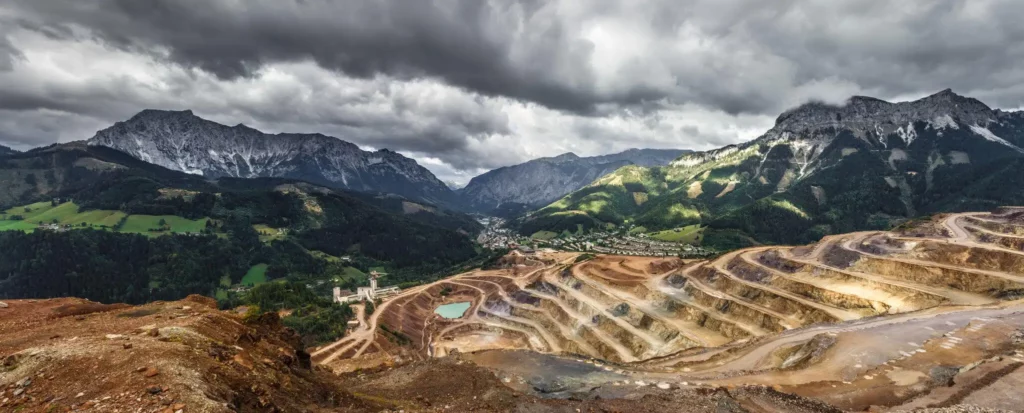
What Is Drone Mining Survey
Drone mining surveying enables a professional to obtain specific Aerial data of mining sites for boosting productivity, planning, safety, inventory management, etc. In the mining industry, Drone Mining Surveys include UAVs furnished with RGB cameras to seize a site’s photographs from various perspectives. The data is then processed through a comprehensive and professional photogrammetry software to compose Geo-tagged 3D Maps, Contour Lines, Digital Terrain Models (DTMs), Digital Surface Models (DSMs), etc. of the mining site for a detailed analysis by the operators.
Sophisticated drone pilots can also effortlessly capture an explicit Stockpile Volume Estimation, which helps with inventory/stockpile management. Industry-specific information such as safety berm heights, crests and toes, road boundaries, widths, crests, slope, length, or elevation change of a mining site can also be achieved through the vocation of high-quality UAVs along with advanced mining software. Along with this, Artificial Intelligence can readily highlight potentially hazardous spheres of the mining site to maintain worker safety.
Why Drones Are Used in Mining
The vital and transformative application of Drones in mining has made it widespread among numerous organizations. UAVs have revitalized the mining industry through Artificial Intelligence coupled with Drone Technology. Offering users excellent efficiency of large mine sites, complete quarry management, and reliable site condition information, mining corporations can now make quick decisions without second-guessing their choices. Drone usage for Surveying, Inspections, Mine Mapping, and many other mining operations have facilitated more trustworthy coordination with crew members, both on-site and off-site, for all the projects’ vigorous insights.
One of the fundamental reasons that Drones have become so widespread in the mining industry is because the data procured via UAVs diminishes the need for on-site workers to adopt traditional survey techniques that require them to visit hazardous or hard-to-reach mine sites. Not just this, drone surveying can be done for almost a fraction of the cost of robust traditional methods and can pocket more accurate data due to advanced technology!
What Are the Trends Influencing Mining
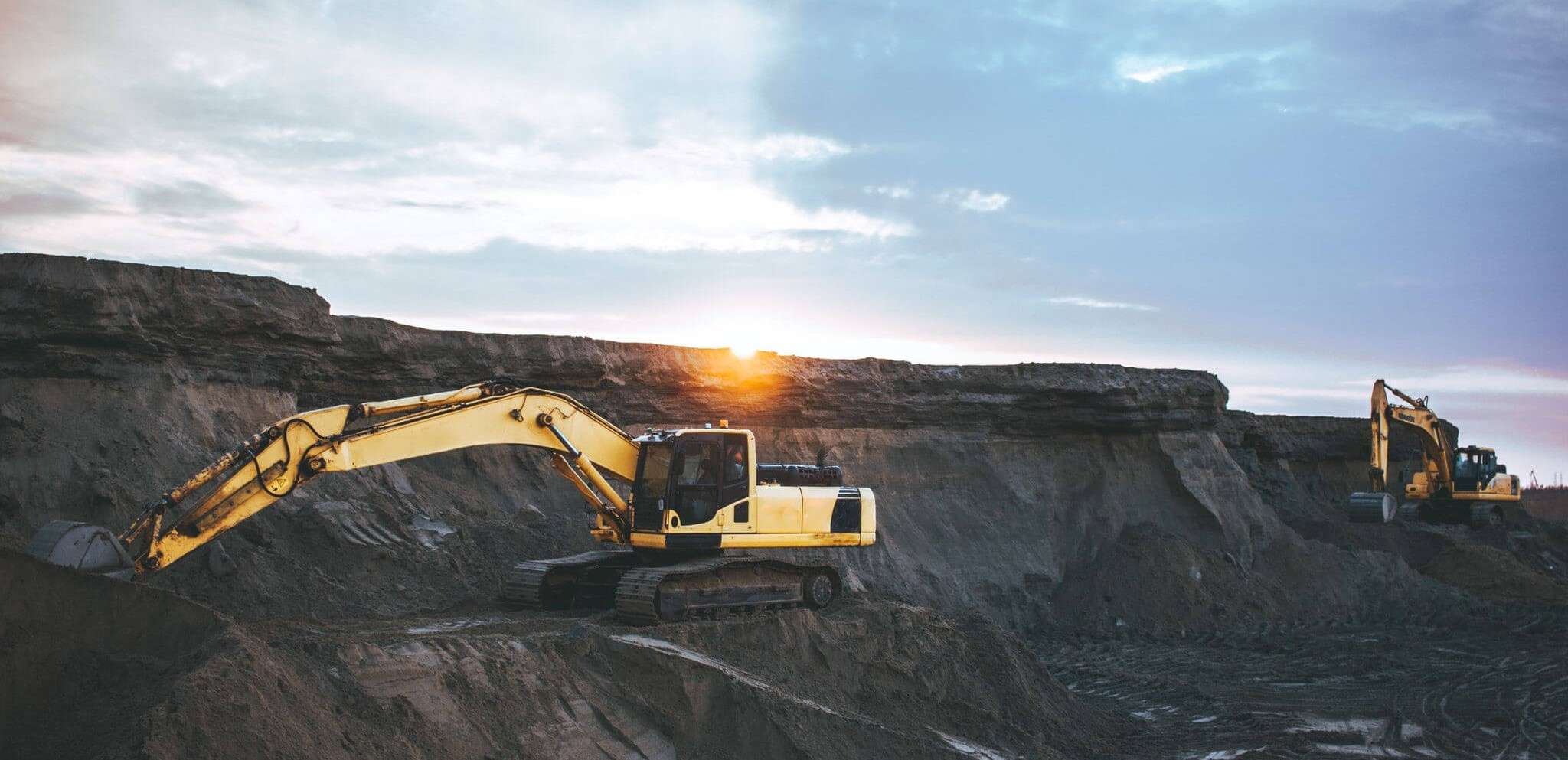
- Monitoring and Inspection – Mining is said to be one of the most hazardous industries for workers. Mining Operations stimulate numerous dangers such as rock falls, high humidity, gas-leaks, dust explosions, floods, and other unfortunate events affecting worker’s safety. The mining industry has employed UAVs and Drone Technology for real monitoring and inspection of deep shafts. Inspection of mining equipment, which previously required a highly experienced workforce, can now be carried out in a comparatively inexpensive and time-efficient method. Depending upon Geographic Information Systems (GIS) and high-grade quality RGB sensors for obtaining data, the Drone Aerial images collected are more precise and reliable than any traditional monitoring and inspection method.
- Surveying and Mapping – Aerial surveying and mapping are one of the most excruciating and time-consuming activities that need regular implementation by the mining industry. With the assistance of high-quality drones and a proficient drone pilot on-site, the cost for detailed Aerial photography is 90% lesser than that of a traditional piloted plane. The GIS data captured can be transformed into 3D models and reliable ortho-images with significant volumetric measurements.
- Stockpile – Managing stockpiles in any industry for that matter is a cumbersome task, but essential for safety. A challenge faced continuously by the mining industry are the ever-changing heights and areas concealed by stockpiles at the job-site. The irregularity of such inventories makes it challenging to determine their volume with accuracy with conventional techniques like GNSS surveying. The traditional methodology for such operations prevents regular surveying and can even become a danger to the surveyor. With the help of drones, mining companies can yield vital information regularly and efficiently.

Stockpile Management Photogrammetry software, 3D models, Digital Terrain Models (DTMs), Digital Elevation Models (DEMs) and even highly detailed contour maps are produced for comprehensive analysis of the stockpile.
- Haulage Road Optimization – Haul road networks hold an essential place in the efficiency and productivity of mining operations. For dependable and consistent transportation, roadway statuses and conditions must frequently be observed. By employing UAVs to capture Aerial data, regular visual evaluations of haul roads can take place. Obtaining relevant information such as length, slopes, and turning angles of the haul roads support engineers and constructors for meticulous preparation, designing, development and upkeep. Drones also accommodate areas more extensively and precisely to guarantee that the roads are constructed following legal standards.
- Mining Exploration – Mining exploration is easily one of the most life-threatening operations that were traditionally carried out by workers of the respective company. With Drone Technology redefining several aspects of the mining industry, the mining exploration has redesigned itself through the implementation of high-quality drones. With UAV data, mining companies can transform survey information into high-resolution orthoimages, DSM maps, RBG maps, etc. via secure photogrammetry software. Mining exploration projects are uncovered at only a portion of traditional survey expenses, and are done efficiently, saving lots of time for the company! Photogrammetry software transforms data for more comprehensive and straightforward knowledge.
- Tailing Dam Monitoring – Employing drones for the surveying and inspection of tailing dams eradicates any danger to workers who indulged in traditional manual surveying techniques.
Tailing Dam Monitoring Aerial imagery assists operators and planners to observe mine-site components like slopes on tailings dams frequently. With Drones, regular monitoring and preservation of dams can be done with no manual requirement close to the subject being managed. Thorough data analysis maintains the goodwill of the asset and avoids any failure.
- Water and Sediment – Drones in the mining industry can also prevent any interruptions in mining operations due to undesired or uncontrolled water and sediment flow. Accurate Drone imagery of flow and tailings operations are remodelled as Digital Elevation Maps (DEMs) for thorough perception and preparation by operators. Consistent visual records of the mine-site can be advanced for monitoring progress, guide planned activities, and regularly update financial audits.


You may also like
Different Kinds of Maps Used in Mining
- Orthomosaic Maps – An orthomosaic map typically comprises numerous orthoimages. Aerial photography that is geometrically adjusted due to camera tilt, topographic relief, or lens distortion is known as an orthoimage. Every pixel on the photograph contains 2D and 3D Geo-tagged data, which supports the measurement of the actual distance between specific points on the map as it would be in real life. Orthomosaic plans allow area, volume, and distance of mine sites and projects to be measured correctly.

Orthomosaic Map - 3D Point Cloud – A point cloud is a 3D visualization that includes millions of Geospatial (X, Y, Z) data and various colour data of the mine site. These Point clouds are known to produce high-resolution information clear of any distortion, and also represent them in 3D Mesh models. The 3D point cloud, an industry-standard software, provides comprehensive outputs for estimating distance (slant & horizontal), area, and volume.

3D Point Cloud - DTM – Drone imagery is employed to produce Digital Terrain Models (DTMs) wherein each pixel comprises data including X, Y, and Z estimation of the highest elevation. DTM includes data comprising frequently spaced 3D mass points and characteristics such as ridges and 3D break lines. It also incorporates linear peculiarities of the bare-Earth terrains, unlike DEM. DTMs are designed via photogrammetry and must have adequate overlapping of each obtained image for an accurate representation.
- DEM – Digital Elevation Models (DEMs) are a bare-Earth elevation model. They are a 3D replication formed from a terrain’s elevation information and are famously utilized in Geographic Information Systems (GIS). A few of their applications include landscape modelling, visualization, planning etc. They embody as a raster (grid with squares that represent elevations) or as vector-based Triangular Irregular Networks (TIN).

Digital Elevation Model (Dem)


Benefits
- Higher accuracy – UAVs for mining operations capture numerous data points when compared to traditional surveying and inspection techniques. Drone Technology encourages the mining industry to procure more accurate and systematic data for mining operations such as volume estimations.
- Quicker data collection – Drone surveys for mine sites enable more rapid data collection, nearly 30x faster than traditional land-based practices carried out by personnel.
- Higher-resolution data – The Drone imagery and Aerial Photography carried out by Drones offer precise and high-resolution photographs and videos when opposed to ground-based traditional inspections and mine mapping.
- Increased worker efficiency – With the use of drone data, mining operations have become more productive and efficient. Workers depend upon the accurate information presented by drones and make well-informed decisions quicker. The time utilised to inspect mine sites in traditional processes is now implemented in other significant mining operations by workers.
- Cost-effective approach – By employing Drones, mining companies are saving several costs, resources, and the time invested when contrasted to a ground-based survey.
- Enhanced worker security – Mine Mapping, Surveying, Inspection, and Monitoring with UAVs is entirely remote and doesn’t demand crew members to be present at the hazardous site.
This blog post is a breath of fresh air! The author’s original perspective and imaginative approach
make it stand out from the rest. I found myself captivated in the compelling storytelling and the
seamless flow of ideas. The author’s enthusiasm for the subject shines through every word, making the reading experience truly pleasurable.
I commend the effort put into crafting such an unique work.
Well done!
I was really delighted to find this website on bing, just what I was looking for : D besides saved to favorites .